
Zekun Li
Saturday, January 2, 2021
Display JPEG historical map tiles in Mapbox
Mapbox is a great tool for visualizing maps especially when you have multiple layers and would like to compare them at the same location.
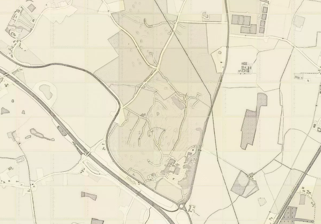
In my case, I have millions of small tiles in jpeg format, and I would like to overlay those tiles on OSM map. Those map tiles are generated from a neural network by taking OSM tiles as input and the resulting tiles are close to historical style. Thus it is interesting for me to compare the OSM map and the synthetic historical map to check the quality of the network output.
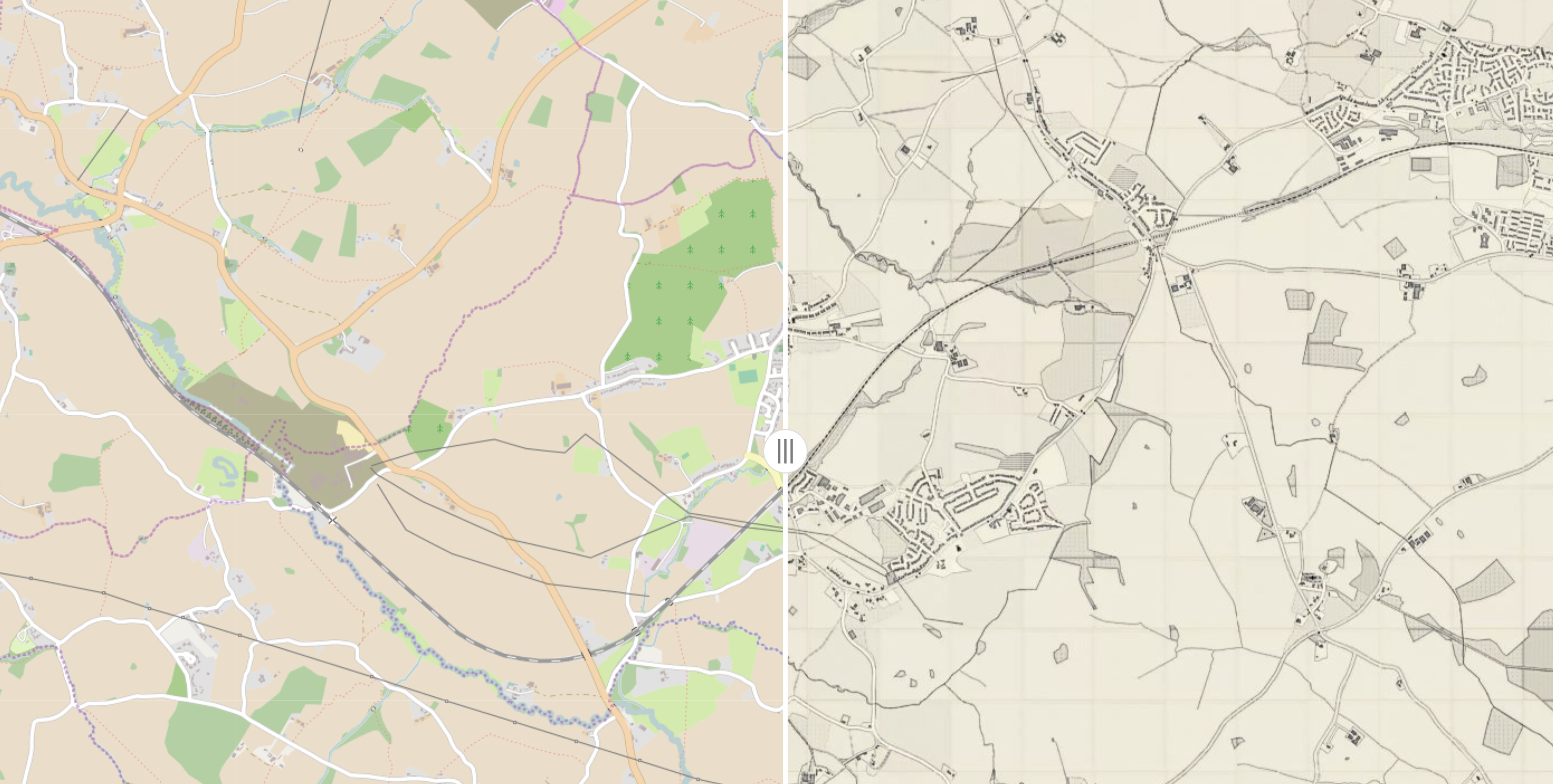
OSM and historical
Create tiff file and upload to Mapbox
We need to create a mapbox account which can be registered here. With mapbox we can specify different base-map (theme) and you can choose the one you like the best. A very nice tutorial about Mapbox (as well as carto) is here by Andy Rutkowski. You could explore mapbox a little bit by following these slides.
Mapbox could read GeoTiff files as Tileset and load them as layers.The easiest way for us is to convert the JPEG images into GeoTiff by adding the lattitude/longitude information, i.e. geo-referencing, then concatenate those small tiff files into one big tiff. Since my historical tiles share the same geo-coordinates as the OSM counterpart, it’s relatively easy to generate a .wrd and .point file and use them to produce Tiff files by using the code here. We just need to do the Step 2 and Step 3 as in the ReadMe to get the Tiff files as output.
At this step, we’ve successfully geo-referencing the JPEG files and get a bunch of Tiff files. We could visualize the Tiff files in QGIS by loading them as layers. But if you prefer to be able to use it as a demo and save it online using Mapbox, we need to do something extra.
Fortunately this extra is not too much. We simply run the following command to concatenate those small tiff files into one big tiff file and name it mosaic.tiff.
gdalbuildvrt mosaic.vrt ?.tif

gdal_translate -of GTiff -co "COMPRESS=JPEG" -co "PHOTOMETRIC=YCBCR" -co "TILED=YES" -co "BIGTIFF=YES" mosaic.vrt mosaic.tif
Display in Mapbox
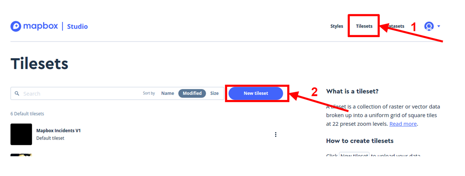
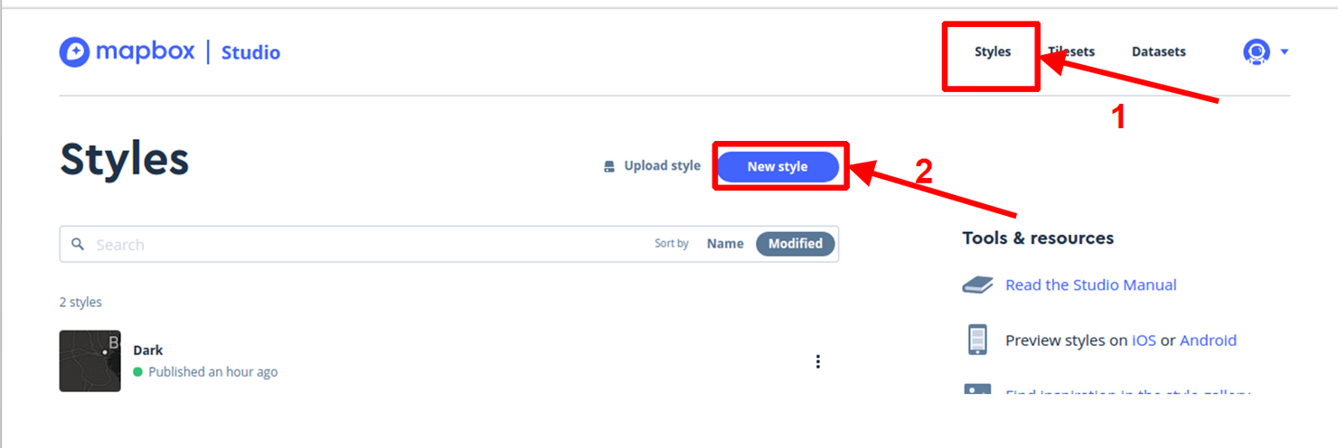
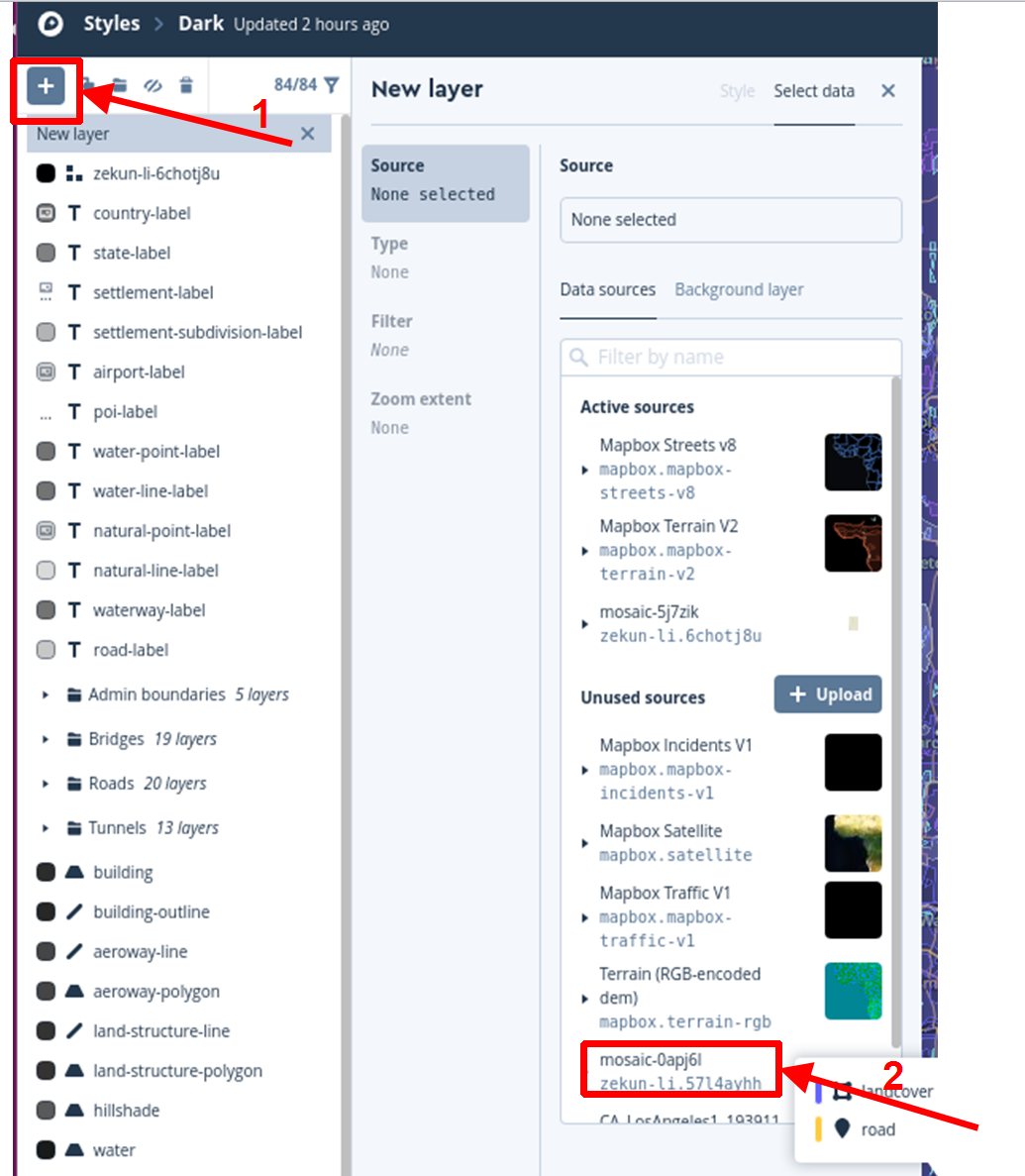
Then in the mapnik, follow the steps below:

step1
step2
step3
step4
Then the tile would successfully appear in Mapbox.
step5
Note:
It is possible that you might need to convert the GeoTiff from PCT to RGB format by running the command bellow:
pct2rgb.py -of GTiff osm_32331_21348_16.tif a.tif