
Zekun Li
Saturday, September 5, 2020
Experience with Mapnik
For some reason, I needed to use mapnik to render the .osm file into tiles (png format), and I started my long journey with mapnik. The task is to render the text label layer only, without any background geographical features.
Things started off smoothly. I found python already have pip installation for mapnik so I simply typed pip install mapnik to install it on my machine. I followed the tutorial here and successfully reproduced the output.
step1
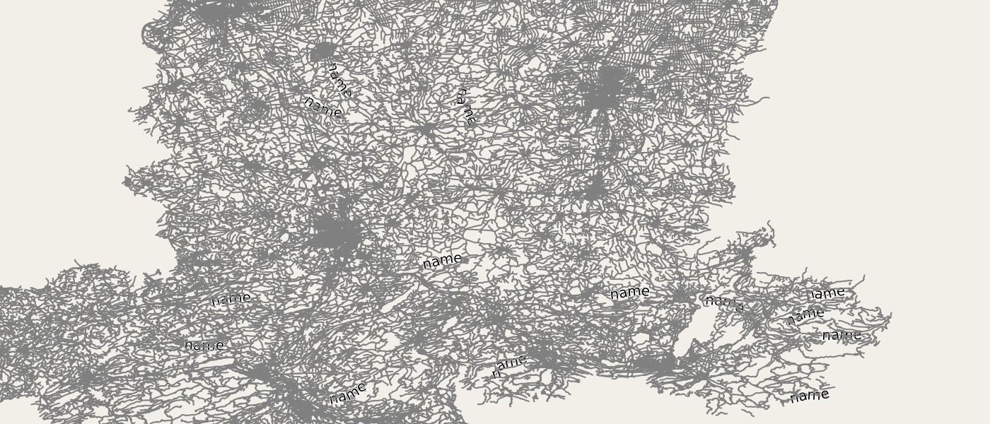
Then I tried zooming into the Britain region and here’s what it looks like…Hmm, not adding any new content, but just a enlarged version of the same picture.

step2
I also tried out with this, although it is out-dated, but I still (kind of) managed to have it work. The catch is that fill should be “#000000” instead of fill="#000". With “#000”, the text wouldn’t show up because it is a wrong color code. I was not able to have it display the real name and it is showing “name” as a placeholder.
step3
The good time didn’t last long. The real suffer just began. Because the above post said it’s out-dated, then I started wondering what the current method is. Turns out it’s Carto. We can use Carto to generate style-sheets (xml format) and feed into mapnik for rasterization.
When I use carto generated style-sheets, it reports error of missing fonts and unrecognized attributes such as following.
Mapnik LOG> 2019-09-25 16:40:59: Unable to process some data while parsing 'src/openstreetmap-carto/zekun_mapnik.xml':

* attribute 'maximum-scale-denominator' with value '25000000' at line 0

* attribute 'minimum-scale-denominator' with value '750000' at line 0

* attribute 'maximum-scale-denominator' with value '750000' at line 0

* attribute 'maximum-scale-denominator' with value '50000' at line 0

* attribute 'maximum-scale-denominator' with value '50000' at line 0

* attribute 'maximum-scale-denominator' with value '50000' at line 0
I googled a little bit and realized it is because mapnik version is too old. The first thing I did was replace the ‘maximum-scale-denominator’ with ‘maxzoom’, similarly for ‘mininum-scale-denominator’. The error disappeared but the result image is just blank.
The second option is to upgrade mapnik to at least v3.0.22. I had to uninstall my mapnik from pip, download the mapnik and python-mapnik then compile from scratch.
But this step is not easy. mapnik installation test was fine but python-mapnik test keeps failing every time.
Traceback (most recent call last):

  File "render3.py", line 3, in <module>

    import mapnik

  File "/usr/local/lib/python2.7/dist-packages/mapnik-4.0.0-py2.7-linux-x86_64.egg/mapnik/__init__.py", line 1071, in <module>

    register_plugins()

  File "/usr/local/lib/python2.7/dist-packages/mapnik-4.0.0-py2.7-linux-x86_64.egg/mapnik/__init__.py", line 1053, in register_plugins

    DatasourceCache.register_datasources(path)

Boost.Python.ArgumentError: Python argument types in

    DatasourceCache.register_datasources(str)

did not match C++ signature:

    register_datasources(std::string)
I kept having trouble with mapnik and python-mapnik because they are not compatible with each other. I uninstalled and reinstalled the packages for about 20 times and still didn’t solve the issue.
In the end, I decided switch to docker installation and was able to make it work. But apparently, this docker still doesn’t have the latest version either, and I was back to the same problem again.
Sigh….
But when I was googling, I came across this question, seems like that person had the same problem as mine. So gave it a try and added the following four lines to the code to convert the coordinate system of the bounding box.
prj = mapnik.Projection("+init=epsg:3857")

wgs84 = mapnik.Projection('+init=epsg:4326')

tr = mapnik.ProjTransform(wgs84, prj)

bbox = tr.forward(bbox)
Surprisingly, this time something showed up.

step4
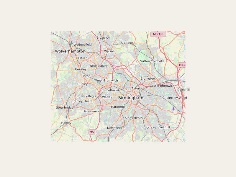
I finally got a piece of code to start with. It shows the Birmingham region that I downloaded.
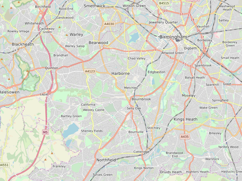
It is only showing one layer because I commented out all the other layers in project.mml when run carto project.mml mapnik.xml. When I added all layers back (except for those require additional shp file), then adjusted the bbox range and image size, I finally got something decent.
step5
and
step6
Anyways, bon voyage.